They tell us it does not happen .....
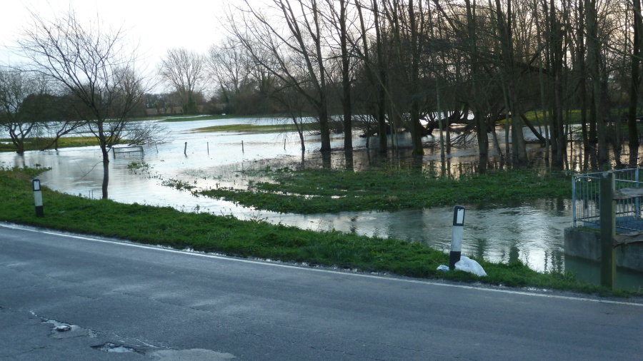
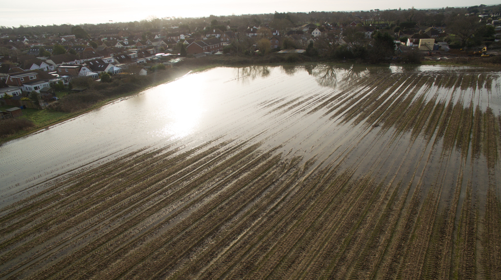
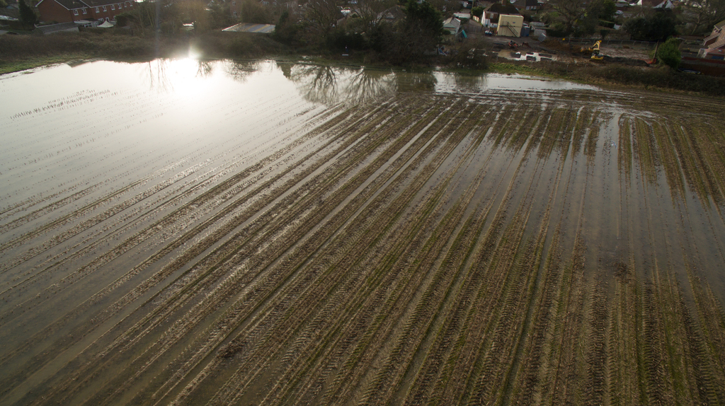
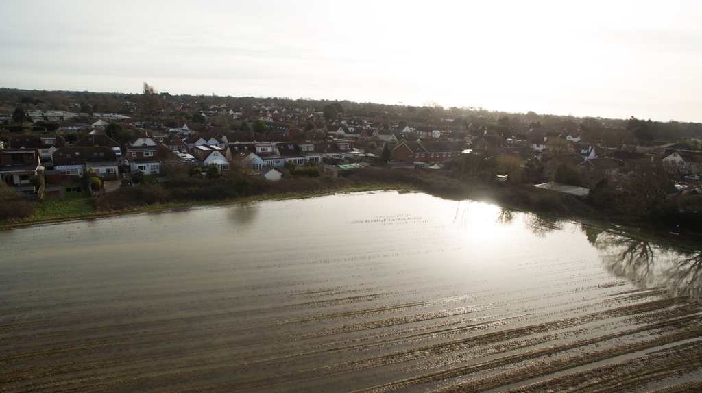
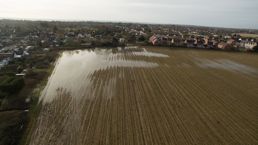
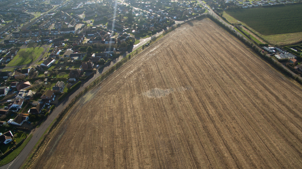
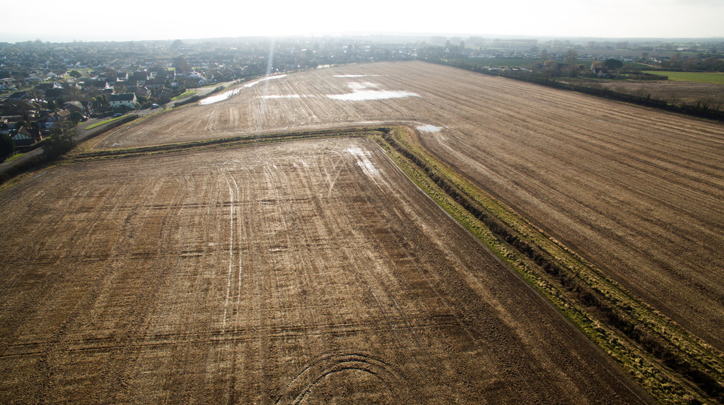
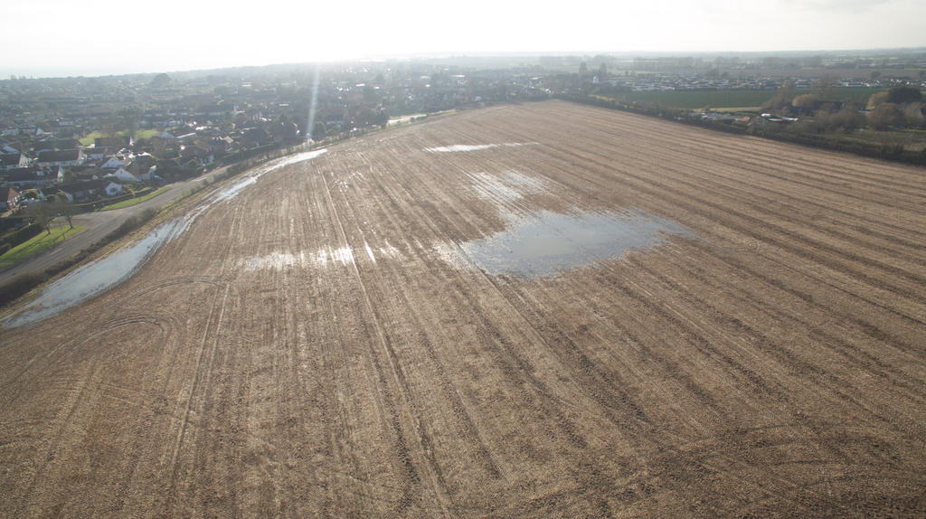
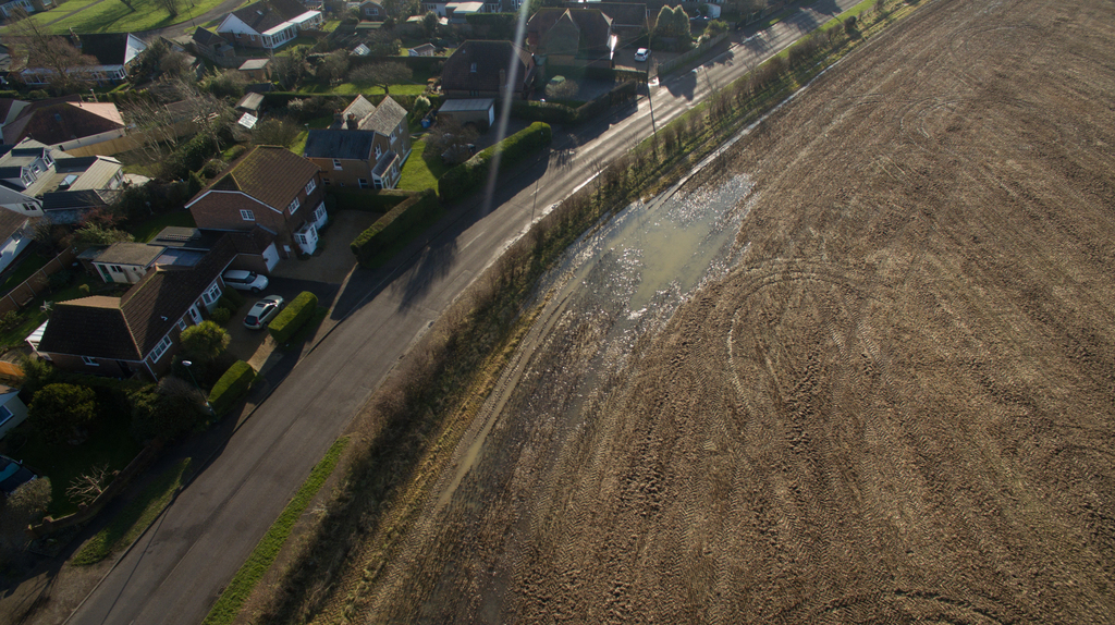
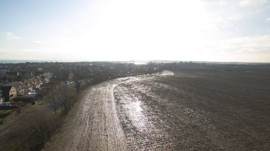
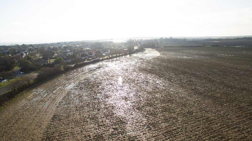
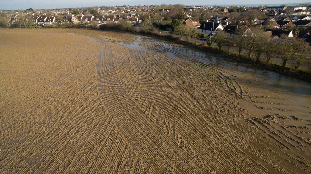
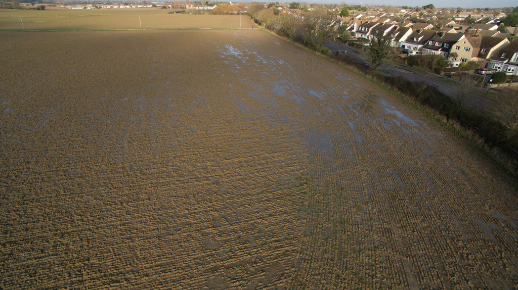
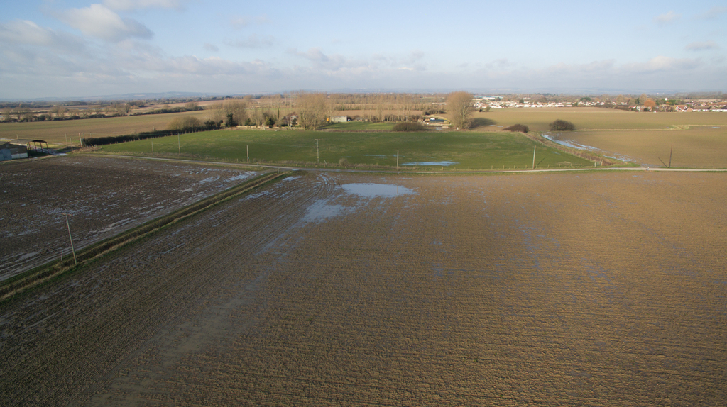
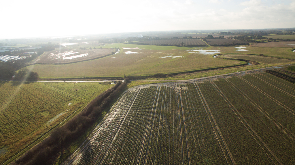
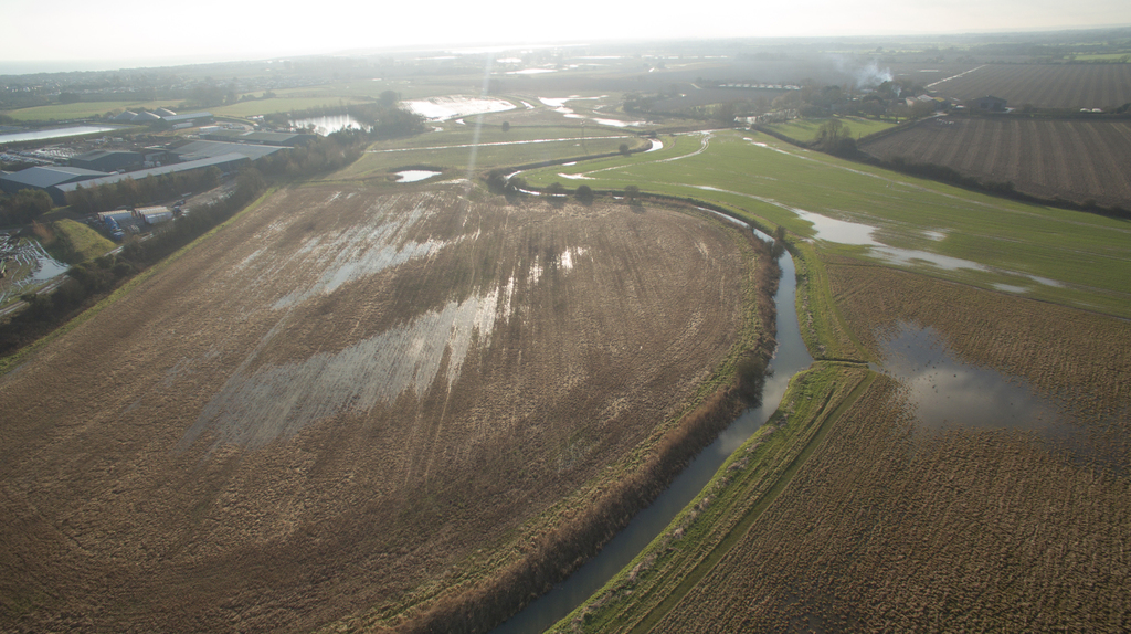
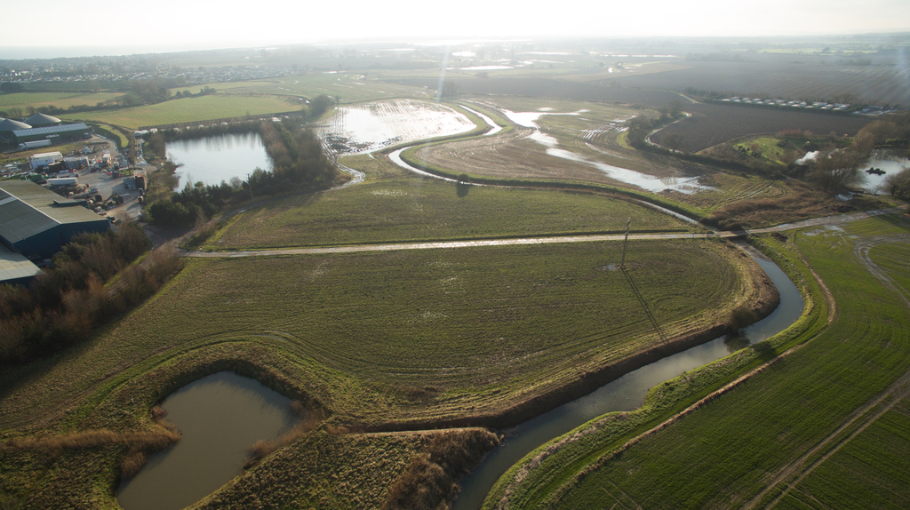
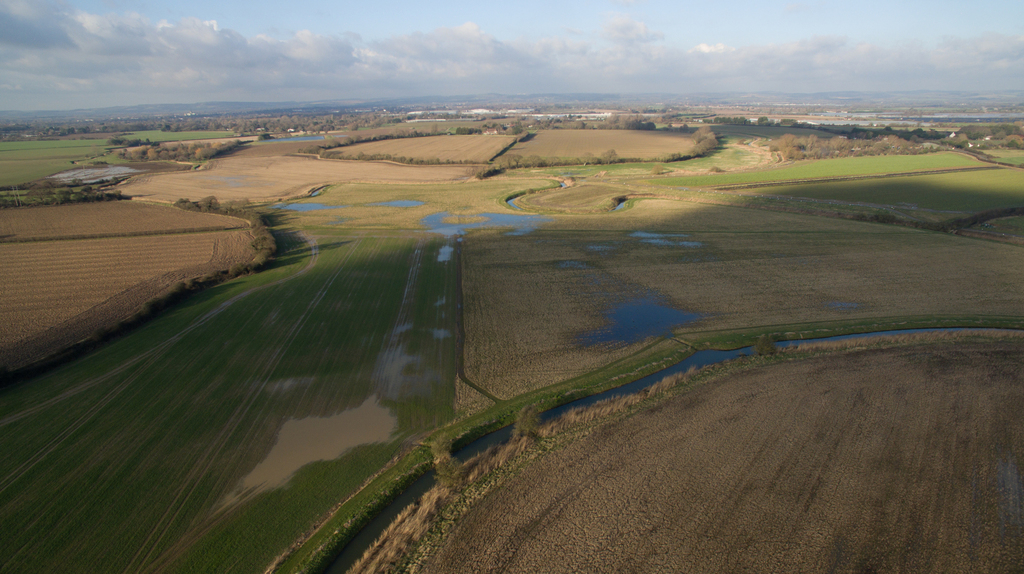
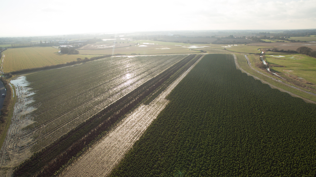
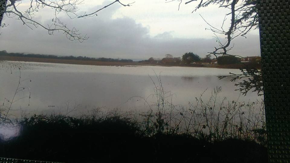
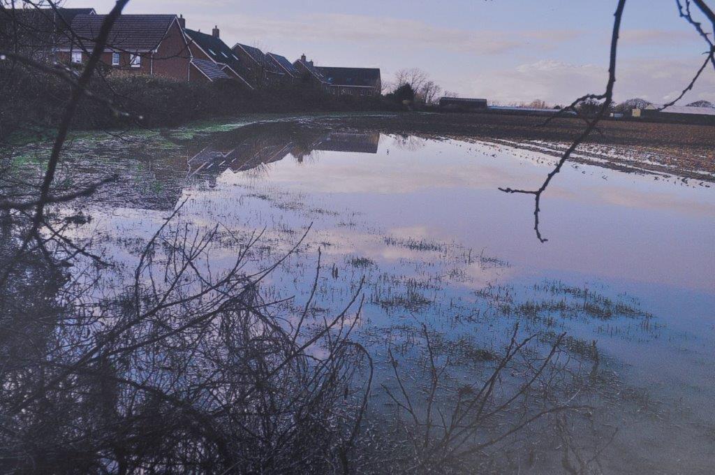
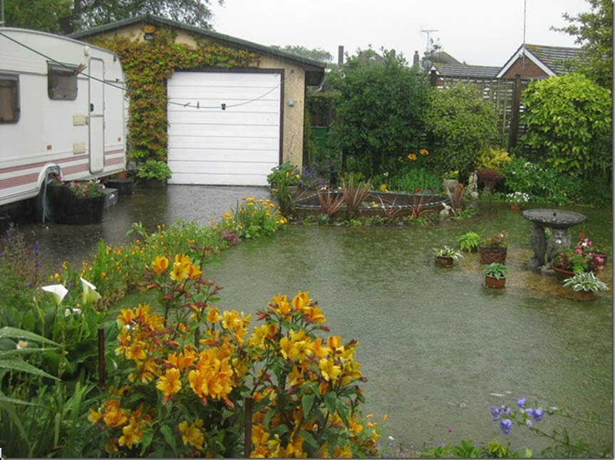
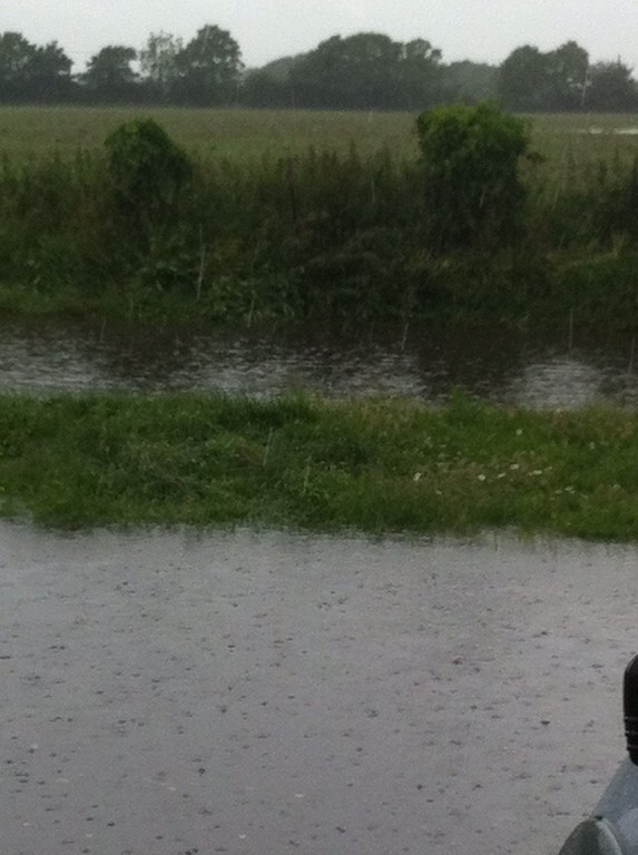
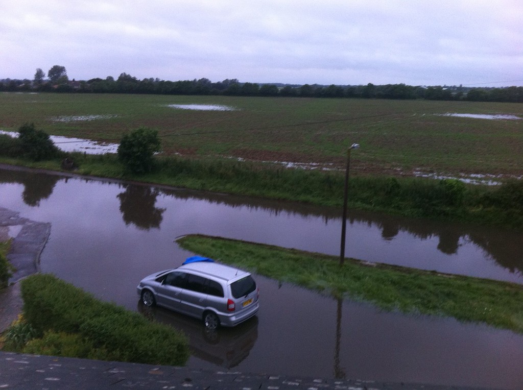
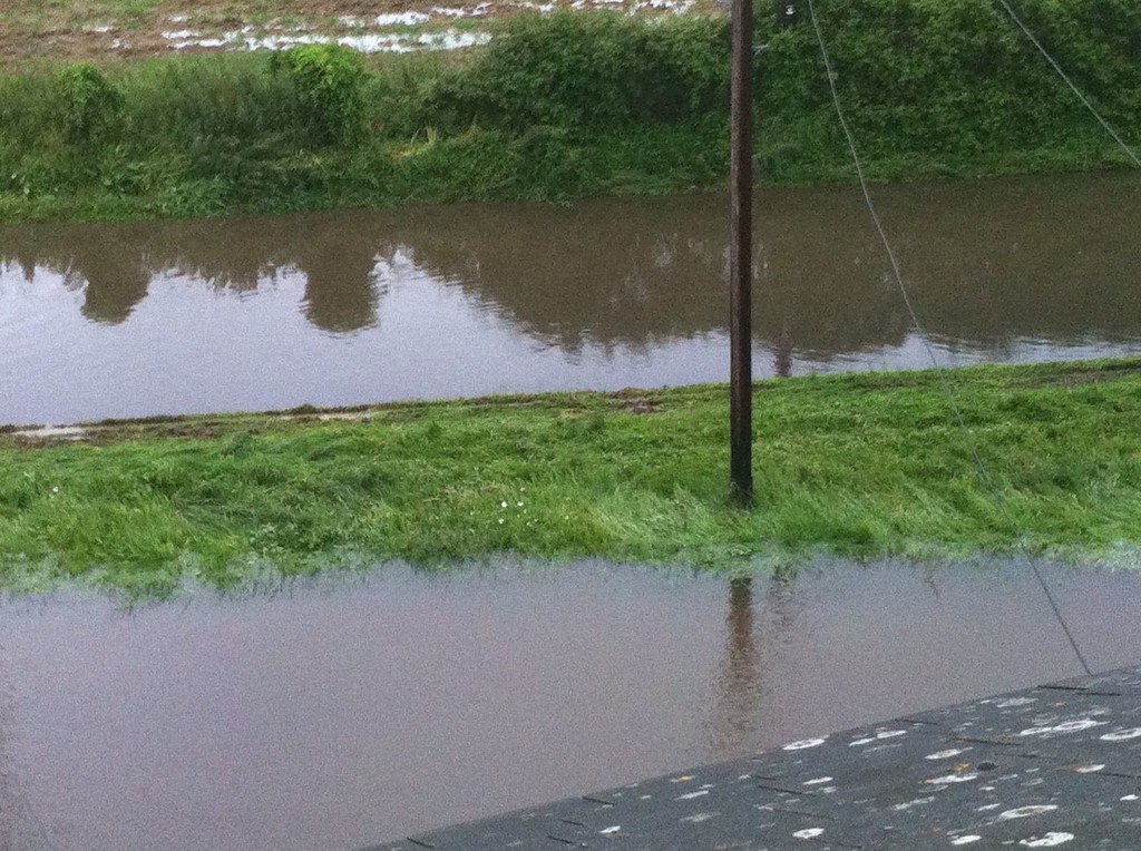
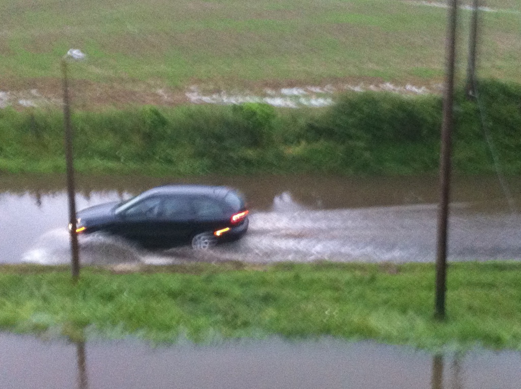
THE FOLLOWING PHOTO'S WERE TAKEN ON THE 26/27TH. JANUARY 2018 BY A 'DRONE' FLYING ABOVE SOME OF THE STRATEGIC SITES THAT DEVELOPERS WANT TO BUILD ON, WE HAVE ALL SEEN FLOODING PHOTOS TAKEN FROM THE GROUND BUT THEY FAIL TO SHOW THE TRUE EXTENT OF HOW MUCH FLOODING THERE REALLY IS, EFFECTIVELY THE WATER TABLE IS ON THE SURFACE OF THE GROUND ... BE SUPRISED AT THESE IMAGES.
SEFTER RD.

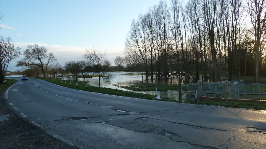
HOOK LANE
PAGHAM ROAD (HANBURY SITE)
BACK OF BARFOOTS SHOWING RIFE & FLOODING
FOR THOSE TECHNICALLY MINDED ON THE WAY THESE IMAGES WERE OBTAINED ... A DJI PHANTOM PRO DRONE WAS USED, CAPABLE OF CLIMBING TO 500 FEET, A RANGE OF 5 KMS., 25 MINS. FLYING TIME, AND THE ABILITY TO OBTAIN HIGH DEFINITION PHOTOS AND VIDEO, WE WILL BE ADDING VIDEO'S SHORTLY. OUR THANKS TO STEVE CAMPION FOR HIS HELP ON 07824 425272 IF YOU WISH TO USE HIS SERVICES.
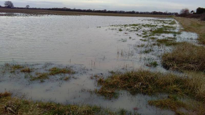
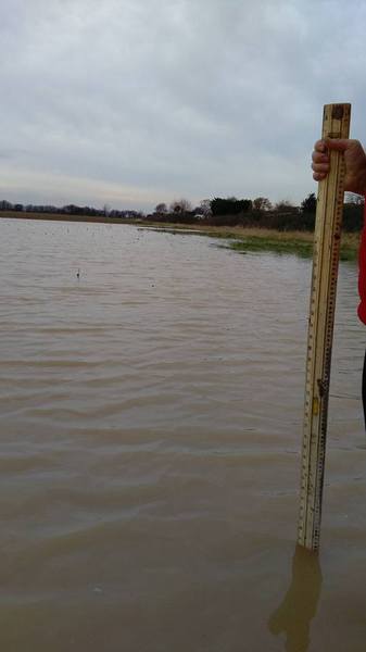
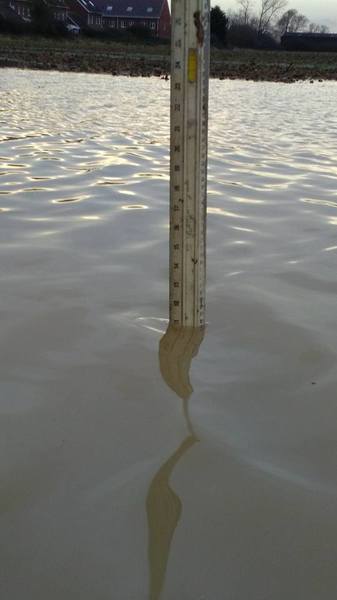
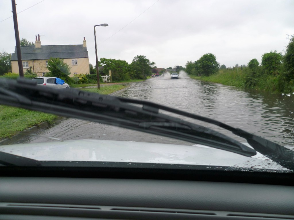
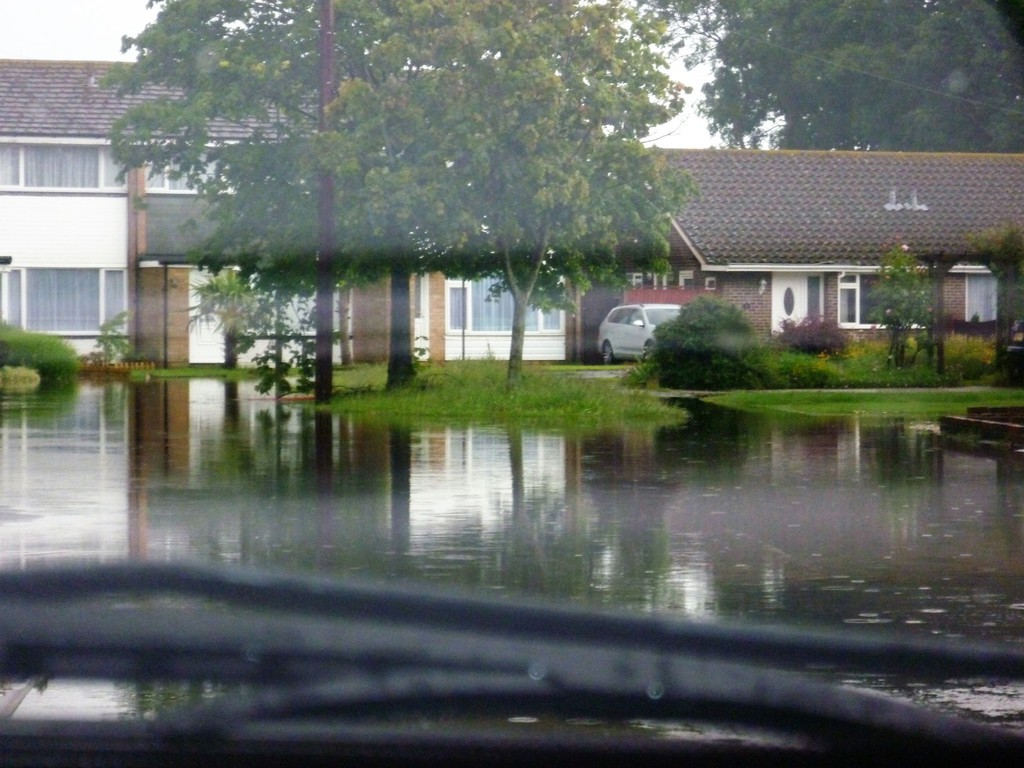
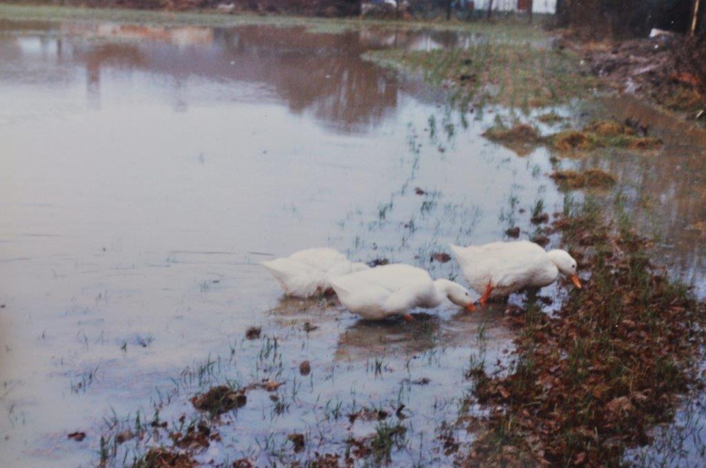
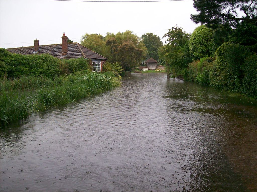
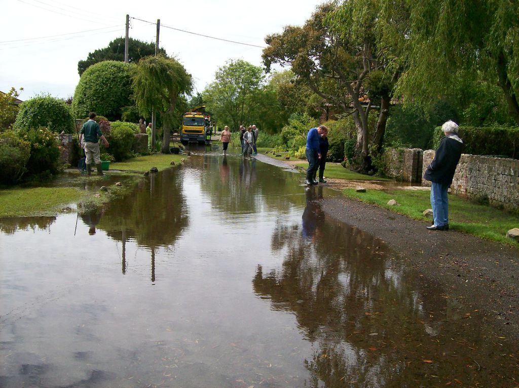
Back to reality and now from the ground ...... SEFTER FIELD
Up to date flooding back of Lincoln Ave, and Gill and Albert Homers property Jan/Feb 2017, the following text from Albert "Photos of Day 5 in Sefter field after a series of weather fronts passed over Bognor Regis .The rainfall figures for 9 days prior to this photo total 51.3mm – about two inches – not a great amount ! The daily totals were fri. 27 Jan 0.2mm/Sat. 28 Jan 1.1mm/Sun 29 Jan 8.6mm/Mon 30 Jan 2.5mm/Tues. 31 Jan 7.1mm(photo day 1)/Wed 1 Feb 8.1mm (photo day 2)/Thurs 2 Jan 14.3mm (photo day3)/Fri.3 Jan 5.6mm (photo day 4)/ Sat 4 Jan 3.8mm (photo day 5)."
Remember, this is the field that WSCC would like us to believe DOES not flood, their reasoning ..... no one has reported it (like its the obvious thing to do and to whom !!)
Our kind thanks to Gerry Bond who supplied these photos of Church Lane in 2012
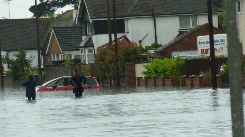
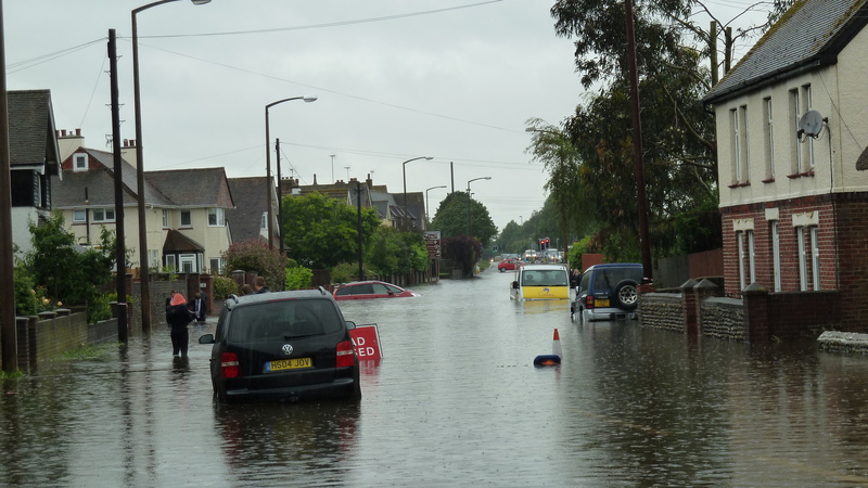
Alan Pivett supplied these photos of Barrack Lane roundabout and the infamous Felpham traffic lights which defied belief in how deep it managed to get, very scary ......
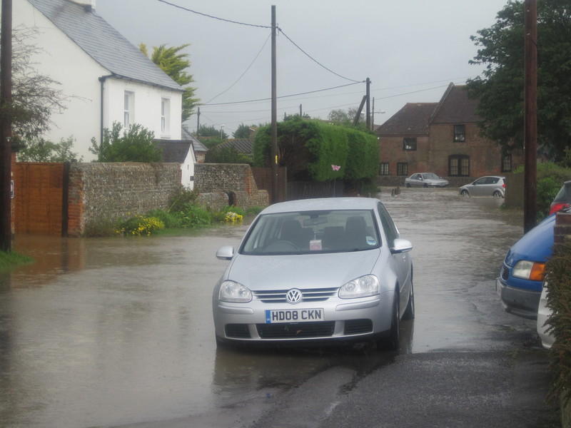
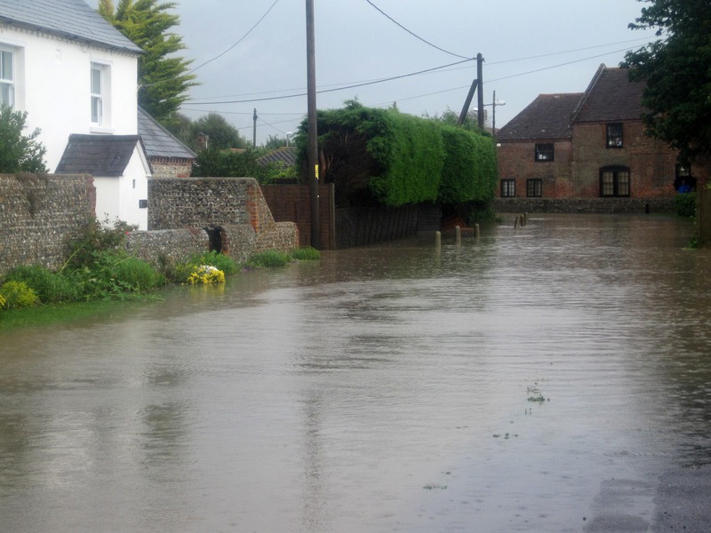
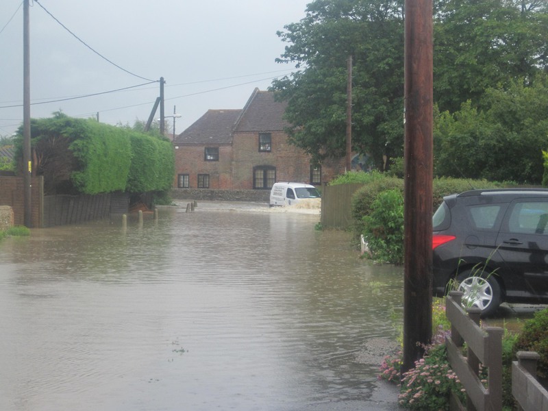
Our thanks to Graham Ede for these photos of the Hook Lane area 2012
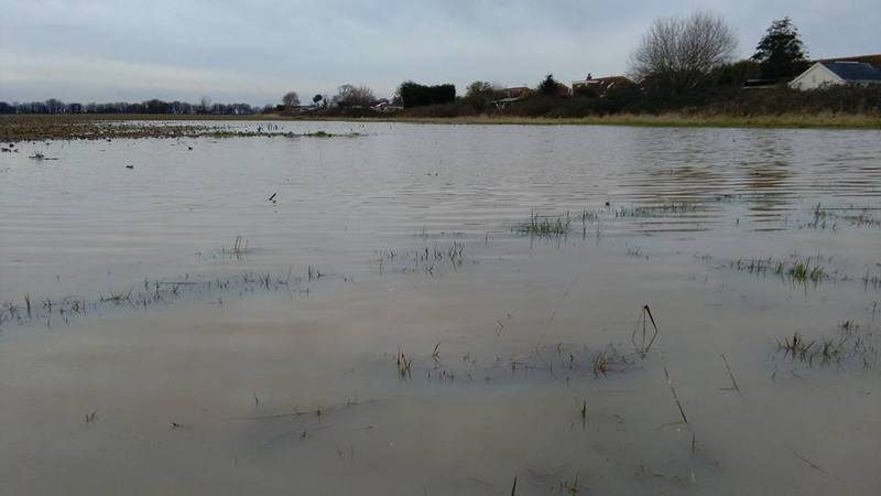
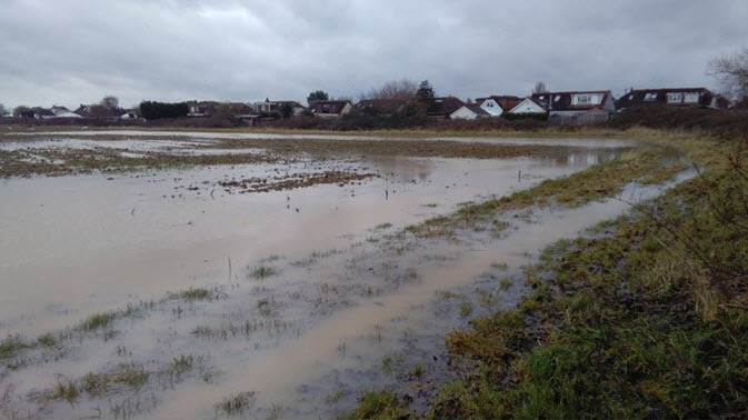
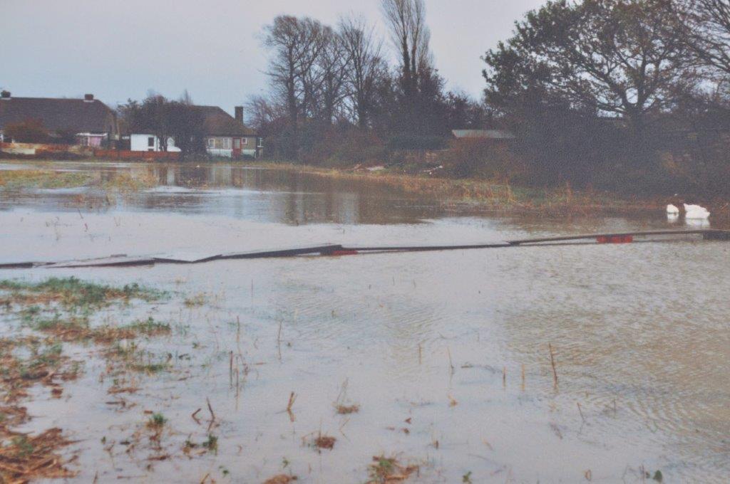
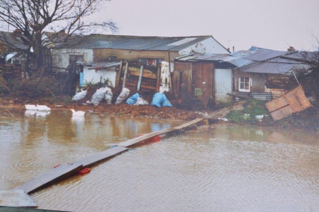
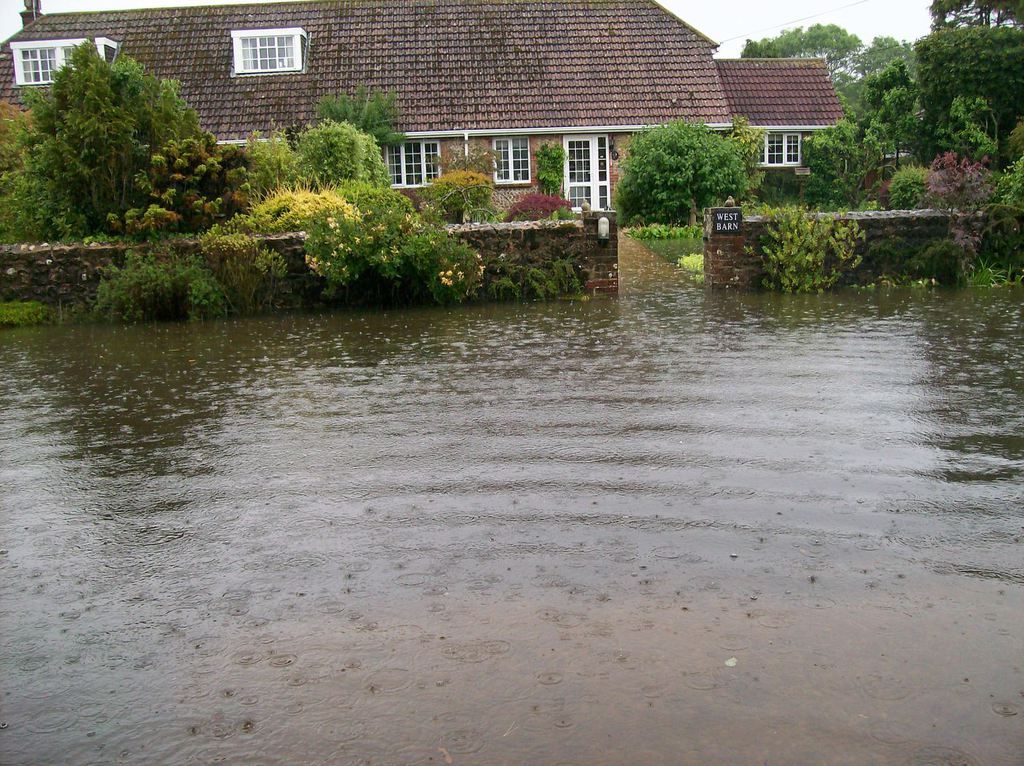
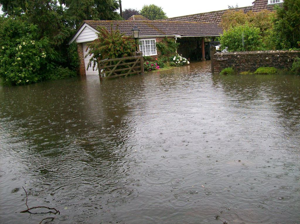
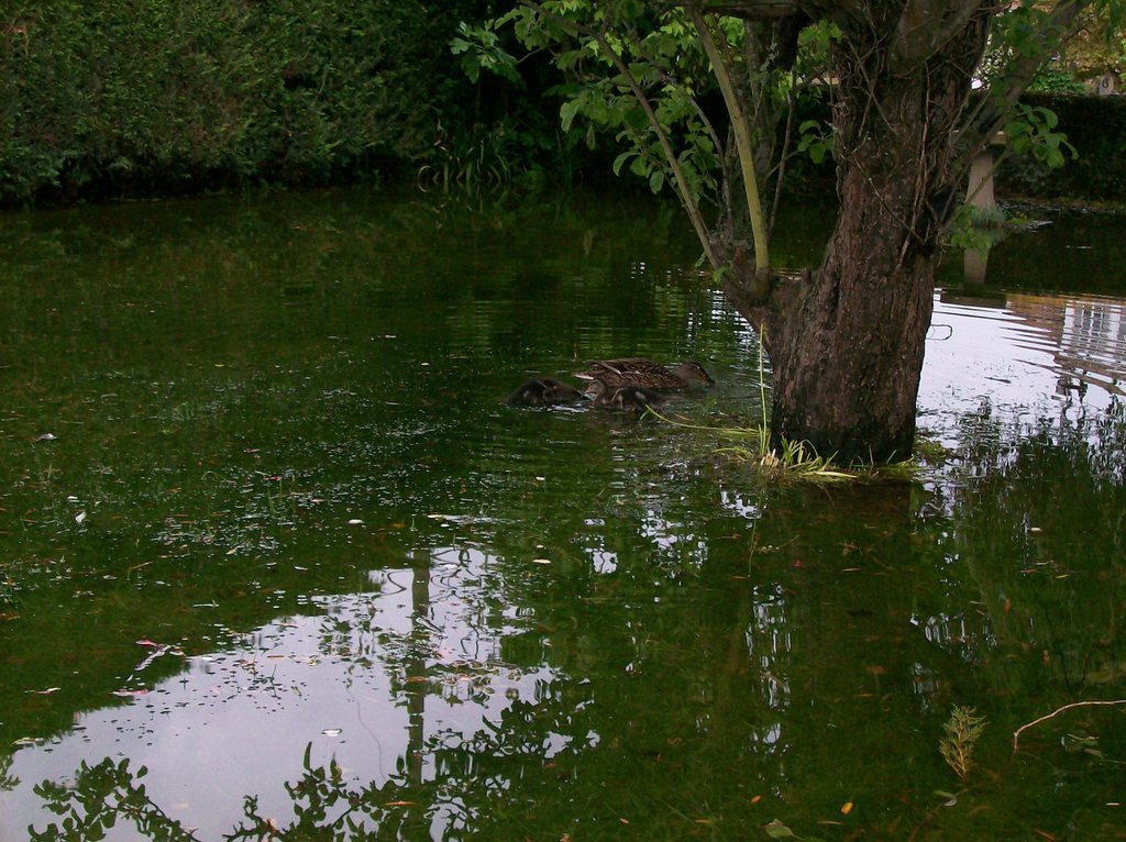
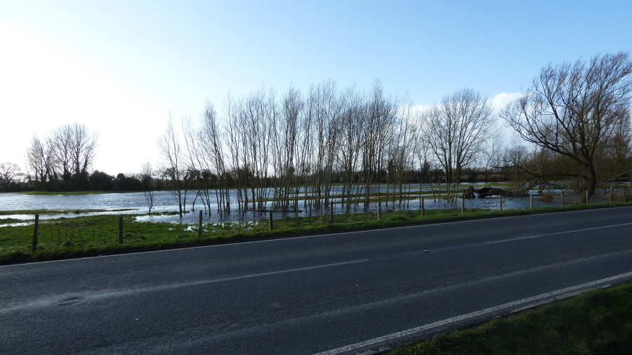
The five images below show historic flooding on the proposed Sefter Site ......Photos are in slideshow
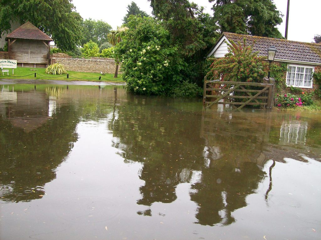
The following slide show gallery depicts Barton Close in 2012 and my kind thanks go to Mike Wake for allowing us to use these photo's. Here is his description of the photo's "I'm attaching 10 photos of the 2012 flooding in Barton Close, where I live. It can be seen that not only was the road impassable where in places it flooded to a depth of 18 inches, and lapping right up to front doors. There is a deep ditch between the back of my property and the Football Ground, apparently before the development of Church Way and Harbour View Road, surface water could drain along this to the sea. "
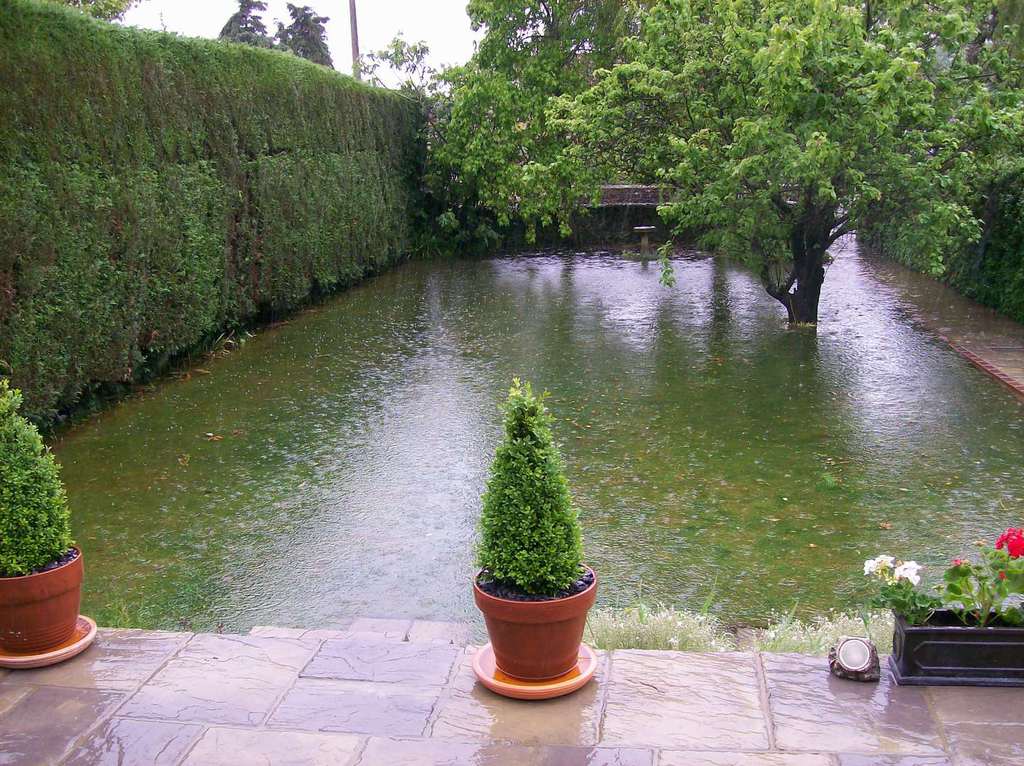
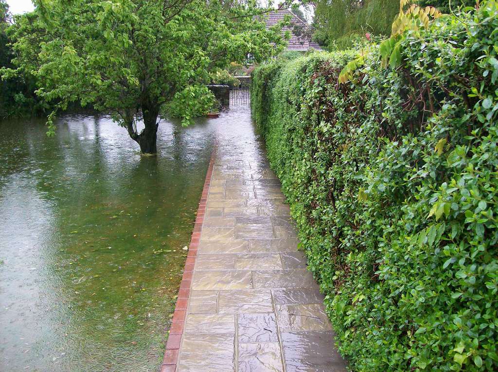
Again our kind thanks for these 5 photos, the first 4 are from Hayley at Global Scaffolding clearly showing the views of Hook Lane at the layby in 2012, the last photo courtesy of Alan Macartney of his neighbours garden on 11th. June 2012 when the water table was very high.
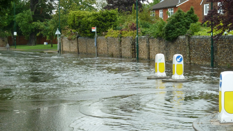
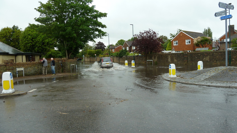
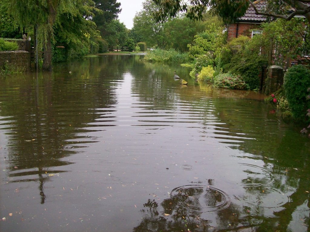
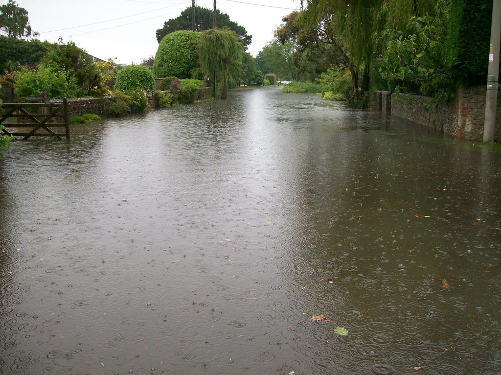
Flooding we are all familiar with, this time at junction of Pagham Road and Sefter Road
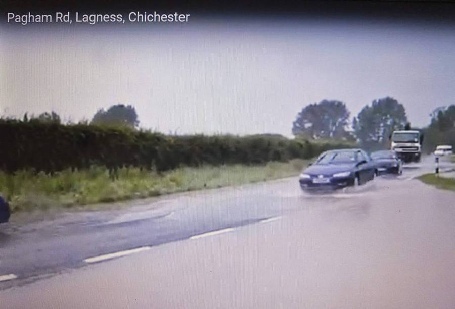
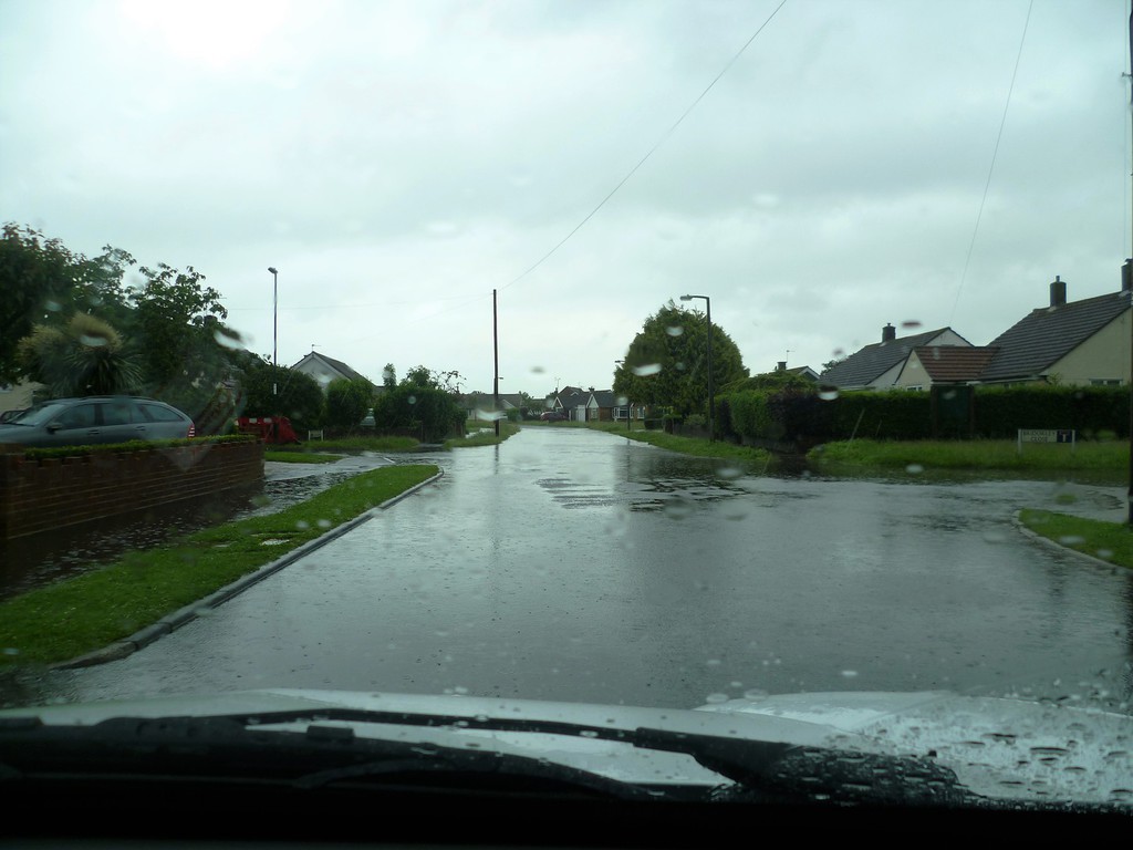
All four photos were taken on 9/2/2014...... Note the condition of the road and the extensive flooding looking east towards Pagham
Same day, looking west towards Manor Nurseries, total flooding of surrounding fields
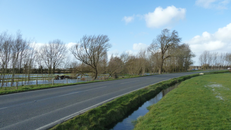
Again, same day, better picture of road damage again ... NOT caused by frost or snow conditions
Again, same day, looking at exit of water from sluice gate, note road damage again ... huge articulated lorries exacerbate this damage